You are here
PCIC Expands Our Data Portal
In 2012 PCIC launched its Data Portal with the BC Station Data Page, making weather observations from more than 6000 stations available to the public. Now PCIC is pleased to announce the expansion of our Data Portal, with the launch of two more data pages, the High-Resolution PRISM Climatology Page and the Statistically Downscaled Climate Scenarios Page. Users can sign in to the portal using OpenID and access the data in three different formats.
 |
|
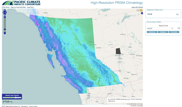
Figure 1: The user interface of the High-Resolution PRISM Climatology Page. |
HIGH RESOLUTION PRISM CLIMATOLOGY
Three years of collaboration and effort went into developing new high-resolution climatologies for BC. These are now publicly available through our High-Resolution PRISM Climatology Page. Producing these climatologies requires an interpolation model that can account for the effects of our varied topography and complex climate regimes. In order do this, PCIC has worked with Oregon State University to adopt their Parameter Regression on Independent Slopes Model (PRISM) technology and apply it to British Columbia. PRISM has been tested and validated throughout the United States and it is applied worldwide. It has also been used in BC in the past. PCIC’s PRISM climatologies use observations of temperature and precipitation from thousands of stations in BC and integrate other sources of information, including digital elevation data, snow data, upper atmosphere climatologies, glacier inventories, and local and expert knowledge in order create a climatology of the province at a scale of 800 metres, for the period of 1971–2000. Because of the inclusion of new data and analysis, these new climatologies are an improvement over earlier PRISM climatologies of the region which were available at a scale of 4 kilometres.
Several regional stakeholders have invested in PCIC's effort to adopt the PRISM technology and make the data publicly available. They include the Pacific Institute for Climate Solutions, the BC Ministry of Environment, the BC Ministry of Forests, Lands and Natural Resource Operations and the partners of the Climate Related Monitoring Project.
 |
|
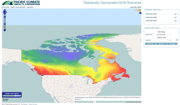
Figure 2: The user interface of the Statistically Downscaled Climate Scenarios Page. |
STATISTICALLY DOWNSCALED CLIMATE SCENARIOS
PCIC is also proud to announce the opening of our Statistically Downscaled Climate Scenarios Page. Using output from Global Climate Models participating in the Fifth Phase of the Coupled Model Intercomparison Project, PCIC has applied a statistical downscaling method called BCSD to create a set of downscaled climate projections of precipitation, minimum temperature and maximum temperature. These are available for three different Representative Concentration Pathways, for all of Canada, at a scale of 300 arc-seconds (roughly 10 kilometres) for the period of 1950–2100.
The support of Environment Canada was instrumental in the development of this new PCIC product.
 Twitter
 Facebook
 Google
 LinkedIn