You are here
Data Portal
PCIC collects and produces the following data, which we make publicly available with an open license: Daily Gridded Meteorological Datasets, BC Station Data, High Resolution PRISM Climatology, Downscaled Climate Scenarios, Gridded and Station Hydrologic Model Outputs, and Future-Shifted Weather Files.

Daily Gridded Meteorological Datasets
Access three gridded meteorological forcing datasets including observed daily station data interpolated to a resolution useful as target datasets for statistical downscaling and hydrologic modelling.
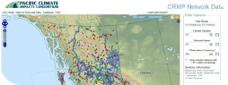
BC Station Data
PCIC provides station observations of weather and climate variables (such as temperature and rainfall amounts) in British Columbia, from 1870 to the present day.

Western Arctic Weather Data
Access observations of weather and climate variables (such as temperature and rainfall amounts) for the Northwest Territories and Yukon from the metnorth database maintained by PCIC.

Weather Files
Future-shifted weather files have been produced at each of the locations in Canada in the CWEC 2016 dataset.

PRISM Climatology and Monthly Timeseries
Obtain high-resolution climatologies of maximum, minimum, and mean temperature and precipitation in British Columbia, on a monthly and annual basis at 30 arc second (~1 km) resolution (developed using PRISM).
Statistically Downscaled Climate Scenarios
Access PCIC's statistically downscaled Canada-wide climate data for precipitation, minimum and maximum temperature at a resolution of 300 arc seconds (~10 km). This includes both historical hindcasts and projections to 2100.

Gridded Hydrologic Model Output
PCIC offers modelled hydrologic data (runoff, baseflow, snow, evaporation and soil moisture) for four basins in BC at the resolution of one-sixteenth of a degree. Projections are available until the year 2098.

Station Hydrologic Model Output
PCIC provides modelled streamflow data for over 120 sites located in four basins in British Columbia. Projections are available as daily time series from 1950 until 2098.